
Rights of way
Explore the village
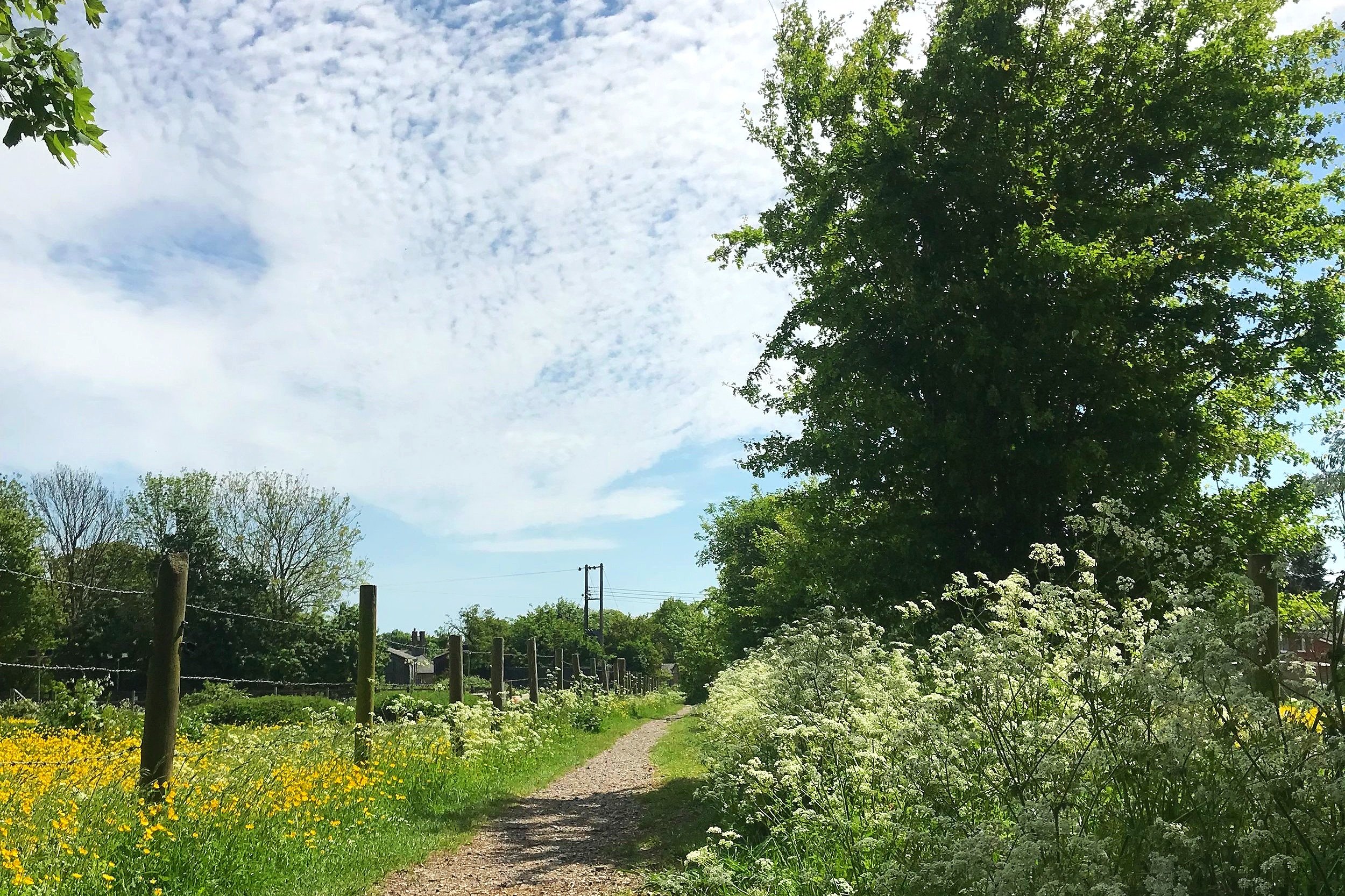
There are many of ancient rights of way in Collingbourne Ducis which will lead you on many exciting routes for exploration. Many routes connect with paths to our neighbouring parishes.
Types of rights of way
There are three basic types of right-of-way. Each right-of-way is numbered according to the Wiltshire Council rights of way map.
-
The general public have a right to pass on foot. It is often marked with YELLOW arrows.
-
The general public have a right to pass on foot, bicycle and horseback. Cyclists must give way to walker and horse riders.
Bridleways are often marked with BLUE arrows.
-
Byways are open to all traffic, though this does not necessarily mean that it is actually passable by all forms of traffic. They are often waymarked with RED arrows.
Respecting our countryside
When you’re out enjoying the countryside, please remember to enjoy yourself and respect the landscape. That means:
guard against all risk of fire
leave livestock, crops and machinery alone, close and fasten all gates and only use gates and stiles to cross fences, hedges and walls
keep dogs under close control
take your litter home and help to keep all water clean
keep to public paths to help protect wildlife, plants and trees
make no unnecessary noise
Find a route
Visit the Wiltshire Council rights of way map or download a PDF map. Each right of way listed below includes the route number, a short description and the approximate Ordnance Survey grid reference for the start and finish (to the nearest 50 metres). Some of the descriptions are old and the language and place names quite fascinating. Note too that the right-of-way path numbers are not consecutive for adjacent paths.
We’re working on creating an interactive Google map to make this easier. Stay tuned!
-
BYWAY - From the Salisbury-Hungerford road A338, at Sunton Farm leading east-north-east to the Railway Arch on the Collingbourne Kingston Parish boundary towards Lynden Barn. Approximate length 137m. Width 3.7m minimum. This path continues as a Collingbourne Kingston byway and then joins with path number 31 below before reaching the Wexcombe road and path 2 below.
-
BRIDLEWAY - Oxford Street. From Cadley Road (C259) nearly opposite Sally Lunn, Cadley, leading generally east-north-east and north-east across Lynden Down to path number 31 below and the Collingbourne Kingston Parish boundary at the Wexcombe Road, C21. Approximate length 1100m, Width 3.7 metres minimum.
-
BRIDLEWAY - From the Salisbury – Hungerford road, A338, at Church Street near the Rectory gate, leading south and south-east to the Mere and then, via a culvert bed, the Ludgershall Road, A346, at a ford south of the Mere. Approximate length 274 m, Width 4.6 to 5.5 metres.
-
BYWAY - From the eastern end of road U/C 8080 just beyond The Shears Inn, leading east-north-east to bridleway No.33. Approximate length 50m.
-
BYWAY - From path No.4 about 64m from the eastern end of road U/ C 8080, leading east-south-east and south-east through Joyce's Copse by a track known as Gravelly Lane to the junction of path Nos. 10 and 11. Approximate length 2.012km.
-
BRIDLEWAY - From path No.7 732 m east of road U/C 8080, leading south past path No.14, over Wick Down to the northern end of Church Ride, path No.16, then along the north-west and south-west boundary of Heaven Corner and the south-west boundary of Heron's Copse to its junction with path No.21 on Blackmore Down on the Ludgershall Parish boundary. Approximate length 2.414km. Width 2.7m.
-
BYWAY - Blackmore Lane. From the junction of Church Ride, path No.16, with path No.21 on Blackmore Down on the Ludgershall Parish boundary, leading north past Pigstye Cottages, and north-east through Collingbourne Wood to the junction of Gravelly Lane, path No.7, with Cowcommon Bottom, path No.11. Approximate length 1.19km.
-
BRIDLEWAY - From its junction with paths Nos.7 and 10 at the eastern end of Gravelly Lane leading generally east to the Ludgershall Parish boundary. Approximate length 900m. Width 2.7m minimum.
-
BRIDLEWAY - Mill Lane. From the Ludgershall road, A346, about 110m south of the bridge over the River Bourne, leading east-south-east and south- east to Hungerford Road, C21, south of Mount Orleans Farm. Approximate length 914 m. Width 3.7 m.
-
FOOTPATH - From Hungerford Road, C21, south of Mount Orleans Farm and opposite Mill Lane, path No.13, leading east, north and east-south-east to path No.8 on Wick Down. Approximate length 1.143km. Width 0.6-0.9m and 3.7-4.6m.
-
FOOTPATH - Page path. From the top of Mill Lane (path No.13), 64m east of the old railway bridge, leading south-east across the Wexcombe Road, C21, and thence east and south-east to path No.8 at Heaven Corner. Approximate length 2.012km. Width 0.6 -0.9m.
Note: the northern end of this path has been plouged up and is currently impassable. However, it can be joined from Mill Lane at the gate some 50 metres further east on Mill Lane by following the signs around the edge of the fields. In additon, there is a permitted path along the old railway line which starts at a sign several metres west of the original starting point of path 15 and terminates at Ludgershall opposite the military railway depot.
-
FOOTPATH - Church Ride. From path No.8 at Heaven Corner leading south-east through the Wood to its junction with paths Nos.10 and 21 on Blackmore Down on the Ludgershall Parish boundary. Approximate length 1.097km. Width 2.7 -3.7m.
-
FOOTPATH - From the Everleigh road, C259, 320 m west of its junction with road U/C 8079, leading south- west past Hazelbury Plantation and across the Devizes road, A342, to its junction with path No.28 on Snail Down. Approximate length 2.414 km. Width 2.7 m.
-
BRIDLEWAY - From the Devizes road, A342, 320m west of its junction with the Salisbury-Hungerford road, A338, leading south-west, west and west-south-west to Fittleton path No.15 at the Parish boundary. Approximate length 2.5km. Width 3.7-4.5m.
-
BYWAY - From the junction of Hungerford Road, C21, with the Ludgershall road, A346, at the top of Shaw Hill, leading south-west across the Devizes road, A342, at Sunny Hill Pond to Southly Bridge on the North Tidworth Parish boundary at its junction with path No.21. Approximate length 1.52km.
-
Path 21 is made up of part BYWAY and part BRIDLEWAY.
SU233510 - SU237511
BYWAY - From the re-aligned section of the Salisbury-Hungerford road, A338, 64m north of the North Tidworth Parish boundary, leading south for 35m then east-north-east to its junction with byway No.19, Collingbourne Ducis.
SU237511 - SU272515
BRIDLEWAY - From Collingbourne Ducis No.19 near Southly Bridge leading east-north-east across A342, Widgely Down and the dismantled railway, along Blackmore Down thence south-east to road U/ C 8072, west of Crawlboys Farm. Approximate length 4.023km.
-
FOOTPATH - Whiteditch Road. From the Ludgershall road, A346, leading south-west, west and south to the Devizes road, A342, at Leckford Bridge. Approximate length 1.609km. Width 2.7m.
-
FOOTPATH - From the northern end of spur road U/C 8078 leading generally north and north-west to the Salisbury-Hungerford road, A338, by way of the footbridge. Approximate length 240m.
-
BRIDLEWAY - From the eastern end of path No.11, leading south-west along the Ludgershall Parish boundary to meet Ludgershall path No.41 at the south-eastern corner of Oxdown Copse. Approximate length 850 m.
-
FOOTPATH - From North Tidworth path No.7, north of Sidbury Camp, leading north-west to Fittleton path No.23, south-east of Weather Hill Firs. Approximate length 1200m.
-
FOOTPATH - From path No.18 at the Ditch on Snail Down leading west to Fittleton path No.13. Approximate length 900m.
-
FOOTPATH - From Chicks Lane C259, leading generally south along the western bank of the River Bourne then east across Little Bridge to its junction with the Ludgershall road, A346. Approximate length 265m.
-
BYWAY - From the Everleigh road, C259, at West Hill, leading north-west past Oldlands Piggery to Collingbourne Kingston path No.14. Approximate length 950m.
-
BYWAY and BRIDLEWAY - White Lane. From the Chute Parish boundary at Shaw Cross as a byway leading generally south-west and west past Herridge Farm and Highlands Farm to the Wexcombe Road then as a bridleway on to path 2 above and Collingbourne Kingston path No.15 (and hence path 1 above). Approximate length 2.5km.
-
FOOTPATH - From path No.31, 230m east of its junction with the Wexcombe road, C21 , leading north-east to the Collingbourne Kingston Parish boundary. Approximate length 800m.
-
BRIDLEWAY - From the northern end of path No.4 leading north-east across Sunton Heath to path No.31, 640m east of Herridge Farm. Approximate length 1.609km.
-
BRIDLEWAY - From the Chute Parish boundary at Fairoak Gate leading south between Fairoak Copse and Coldridge Wood to Ludgershall path No.40. Approximate length 500m.
-
BRIDLEWAY - From path No.7 at the western boundary of Merrylawn Copse leading generally north-north-east along the western boundary of Merrylawn Copse and Whittle Copse then north-north-west along the western boundary of Prancley Copse to its junction with path No.31, about 670m east of Herridge Farm. Approximate length 1.426km. Width 3m.
-
BRIDLEWAY - From the Chute Parish boundary on Chute Down leading south and south-west through Coldridge Wood to path No.34. Approximate length 640m.
-
BRIDLEWAY - From the junction of paths Nos.7, 10 and 11 at Cowcommon Bottom leading north through Collingbourne Wood, across Chute Ride, path No.38, and along Water Lane and White Lane, to its junction with path No.31. (With a spur running to the west along the southern boundaries of White Lane Copse and Prancley Copse to path No.35). Approximate length 2.45km.
-
BRIDLEWAY - Chute Ride. From path No.35 on the western boundary of Merrylawn Copse leading east along Chute Ride to Chute path No.36 at Shaw Farm. Approximate length 1.35km.
-
BRIDLEWAY - From path No.11 at Cowcommon Bottom, at the northern edge of Wickheath Copse, leading north and north-west through Collingbourne Wood, along Water Lane Bottom to path No.37 just south of its junction with Chute Ride path No.38. Approximate length 1.262km.
-
BRIDLEWAY - From the south-western end of Chute path No.6 at Honey Bottom leading south-west through Coldridge Copse to the Ludgershall Parish boundary. Approximate length 1.097km.
-
FOOTPATH - From path No.32 leading north-west to the Collingbourne Kingston Parish boundary and its junction with Collingbourne Kingston path No.17. Approximate length 40m.